Detailed geophysical and geological investigations to identify copper lead and zinc mineralization around Ambaji, Banaskantha district are in progress.

 Skip To Main Content
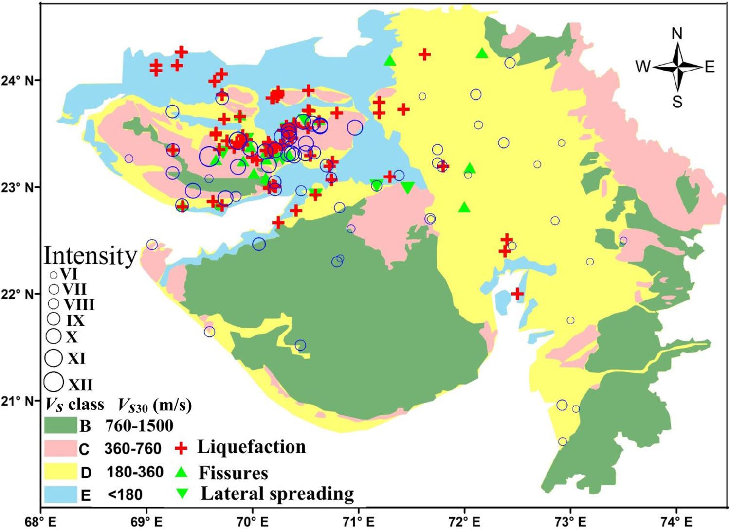
We carried out shallow subsurface investigations at 600 sites covering all types of geological units in the Northwestern Deccan Volcanic Province of India, using the multichannel analysis of surface waves and suspension PS‐logging methods. The results reveal that VS30 values are in the range of 760–1500 m/s for granites and Deccan traps, thus enabling their classification as B‐class, as per the National Earthquake Hazard Reduction Program recommendations. The Tertiary, Cretaceous, Jurassic and Paleoproterozoic sediments show VS30 values between 360 and 760 m/s, and hence, are assigned C‐class. Further, the Quaternary soils are categorized as D‐class, since they show VS30 in the range of 180–360 m/s. Also, the Holocene tidal flat and Rann sediments are classified as E‐class, since the VS30 values are less than 180 m/s. The observed site response reveals that the D‐ and E‐type soils have significantly higher seismic amplification than that in the B‐ and C‐category soils. We noticed that the buildings on D‐ and E‐classes soils experienced higher damage than those on the B‐ and C‐classes, during the past large earthquakes in the Northwestern Deccan Volcanic Province. Our study suggests that VS30 is a good proxy for soil classifications in the Northwestern Deccan Volcanic Province. We validated our results using available geological, geophysical and geotechnical data. For the first time, a regional site characterization map for the Northwestern Deccan Volcanic Province of India is prepared based on geology and VS30.

Map illustrating the site characterization of the Gujarat region
Sairam B., Singh A. P., Patel V., Chopra S., Kumar M. R. (2019) VS30 mapping and site characterization in the seismically active intraplate region of Western India‐implications for risk mitigation, Near Surface Geophysics, 17(5), 533-546.
Copyright © 2017 - All Rights Reserved by - Official Website of Institute of Seismological Research, Government Of Gujarat, India.
Note: Content on this website is published and managed by Institute of Seismological Research.
For any query regarding this website, please contact the web information manager Mr. Jignesh Patel (Technical Officer) : email id-dg-isr[at]gujarat[dot]gov[dot]in
