Detailed geophysical and geological investigations to identify copper lead and zinc mineralization around Ambaji, Banaskantha district are in progress.

 Skip To Main Content
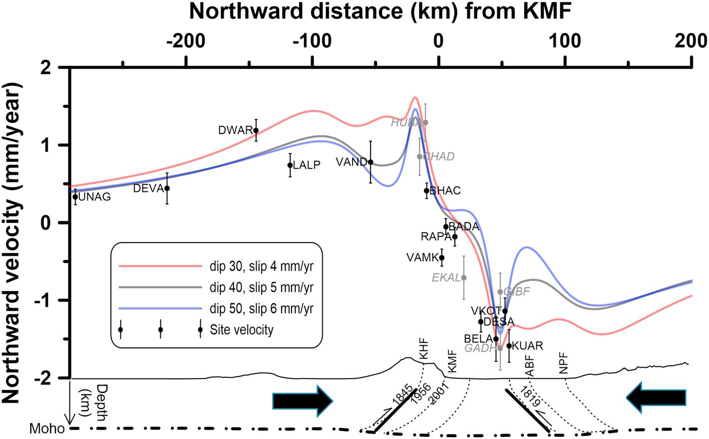
In the past 200 years, the Kachchh paleorift in western India, a plate interior region, has witnessed unusually large number of strong earthquakes, namely, the 2001 Bhuj (Mw 7.6), 1956 Anjar (Mw 6.0), 1845 Lakhpat (Mw ~6), and 1819 Allah Bund (Mw ~7.7) earthquakes. We report continuous GPS measurements from the Kachchh and adjoining region. We find that the ongoing deformation during 2009–2016 is inconsistent with the models of postseismic deformation due to the 2001 Bhuj earthquake. The current widespread deformation pattern implies that the paleorift, bounded by the Kachchh Mainland fault and several other faults along its southern flank and the Allah Bund fault and Nagar Parker fault along its northern flank, is under long‐term compression from both sides at a rate of ~4–5 mm/year. We show that most of this compression is released seismically, making this one of the most seismically active paleorifts in the world.

Variation of northward site velocity along a north‐south profile. The three curves show the modeled response of slip on faults on either sides of the paleorift.
Gahalaut V. K., Gahalaut K., Dumka R. K., Choudhury P., Yadav R. K. (2019) Geodetic Evidence of High Compression Across Seismically Active Kachchh Paleorift, India, Tectonics, doi: 10.1029/2019TC005496
Copyright © 2017 - All Rights Reserved by - Official Website of Institute of Seismological Research, Government Of Gujarat, India.
Note: Content on this website is published and managed by Institute of Seismological Research.
For any query regarding this website, please contact the web information manager Mr. Jignesh Patel (Technical Officer) : email id-dg-isr[at]gujarat[dot]gov[dot]in
